Currently the geography department at Macmillan Academy is working closely with the Ordnance Survey using a new piece of software called 'Digimaps', a new mapping tool for students.
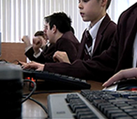
Currently the geography department at Macmillan Academy is working closely with the Ordnance Survey using a new piece of software called 'Digimaps'. This is a mapping tool which allows students to investigate their local area and allows them to incorporate images, measure distances, highlight areas of land use. The advance tools can allow students to investigate areas around a river that may be prone to flooding as well as a variety of different applications. 'Digimaps' works on the same principle as Google earth (it is created through layers on a map also known as Geographical Information Systems).